


L3
ESI-500 Electronic Standby Instrument
Part No: ESI-500
Call for price
Shipping calculated at checkout.
DESCRIPTION
ESI-500 Electronic Standby Instrument
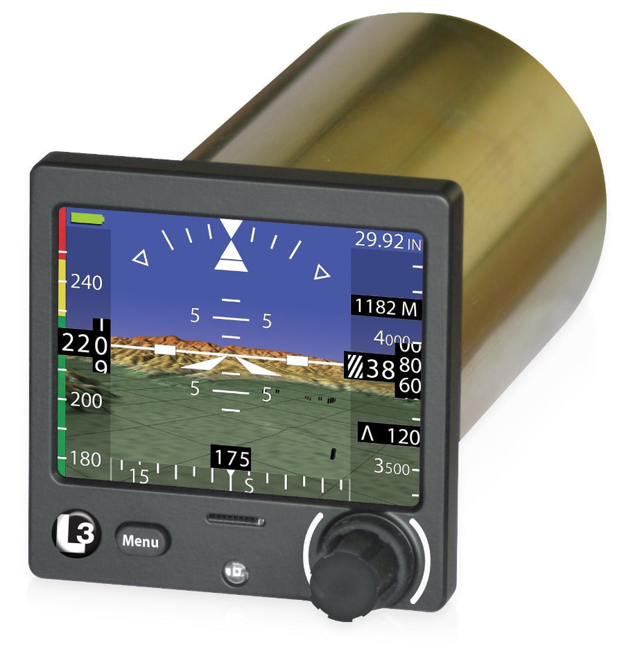
L-3’s Next Generation Electronic Standby Instrument System — the ESI-500 — is one of the most advanced standby instruments designed specifically for piston and turboprop aircraft and helicopters. The compact unit is scalable and comes standard with altitude, attitude, slip/skid, vertical speed and aircraft track. Options are available for the display of navigation information and Synthetic Vision (SynVis), including terrain and obstacles. Magnetic heading is an available option when coupled with the low cost and compact MAG-500 magnetometer. The ESI-500 is compatible with existing NAV radios and GPS hardware. An internal lithium-ion battery pack automatically powers the system without interruption upon loss of main input power.
KEY FEATURES
High-resolution, full color display
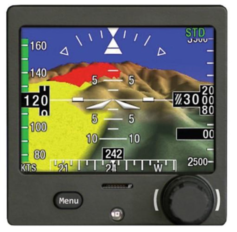
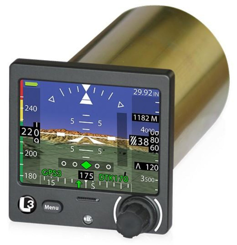
The scalable ESI-500 has numerous display configurations, including navigation, metric altitude, vertical speed and heading. The navigation function can be configured for VOR/ILS or GPS single-source or both. In the absence of a Heading source, the ESI can display aircraft “Track” from a GPS source.
Built-in back-up battery
The ESI-500 also features an internal lithium-ion battery, which will automatically power the unit without interruption should the system lose the aircraft power. This ensures that pilots will have the critical attitude, altitude and airspeed information they need to fly to a suitable airport.
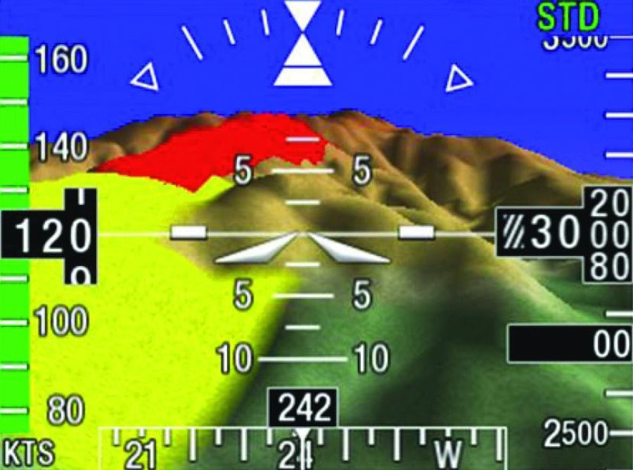
Optional Synthetic Vision display capabilities
The ESI-500 is compatible with a variety of Synthetic Vision Systems enabling it to display color representations of critical information about terrain and known obstacles along the aircraft’s flight path. SynVis depicts three-dimensional terrain and obstacles to reflect topography and hazards, and terrain and obstacle impact alerts are shaded to increase situational awareness. In addition, the unit can also display magnetic heading when coupled with the optional MAG-500 magnetometer.
Features
- Electronic Standby Instrument System
- 3.5" viewable
- High-resolution, 24-bit color display
- Designed specifically for Part 23 (Class I, II & III) airplanes and Part 27 rotorcraft
- Mirrors PFD presenting attitude, altitude, airspeed and slip data
- Options for terrain, SynVis, obstacles, heading and navigation
- Internal lithium-ion battery offers uninterrupted flight data
- Low-cost, compact design for piston and turboprop aircraft
- 3″ round case for easy installation into existing panel cutouts
- Airspeed awareness band highlights aircraft VNE and VMO cues
- Magnetic heading is an available option when coupled with the MAG-500 magnetometer
- Compatible with existing NAV radios and GPS hardware
- Internal lithium-ion battery pack automatically powers the system without interruption upon loss of main input power
- Interfaces:
- (5) ARINC 429 Inputs
- ARINC 429 Output
- RS-485 Serial Input (interfaces with MAG-500)
- Analog Input (OAT)
- Discrete Output
- Dimming Bus
- I2C Interface to the DCM-500
Specifications
| WEIGHT | Nominal 2.1 lb. (0.95 kg) – Maximum 2.75 lb. (1.25 kg) |
| INTERFACES | (5) ARINC 429 Inputs, (1) ARINC 429 Output, (1) RS-485 Serial Input (interfaces with MAG-500), (1) Analog Input (OAT), (1) Discrete Output, (1) Dimming Bus, (1) I2C interface to the DCM-500 |
| POWER | 14V or 28 VDC electrical systems (10 to 32 VDC) |
| NAVIGATION | VOR/ILS or GPS Navigation or both |
| TSO | C2d, C8e, C10b, C34e, C35d, C36e, C40c, C46a, C106, C113a, C179a, C201 |
| ETSO | EASA accepted in accordance with FAA-EASA Technical Implementation Procedures (TIP) Rev 5 (paragraph 2.5.1 ‘TSO/ETSO Articles Accepted under Reciprocal Acceptance’). No ETSO marking on the Articles is required. |
Why Pacific Coast Avionics?
Pacific Coast Avionics is a leading supplier of avionics, pilot supplies and aircraft services.
Since 1991 Pacific Coast Avionics has been providing quality merchandise from name brand manufacturers to keep pilots, aircraft owners and operators flying.
Questions? Call us Toll Free: 800-353-0370